
SECOND CYCLE OF PLANNING 2022-2027
In accordance with the royal decree no. 903/2010, of 9 july, assessment and management of flood risks, management plans flood Risk will be reviewed and updated every six years. This review will be based on the previous Management of flood Risk adopted in 2016, which is updated to include the components identified in part B of the annex to the RD 903/2010, as the assessment of progress, the measures envisaged, but not implemented or additional measures.
The review and updating of the Plan for managing the risk of flooding, hydrographic Demarcation Safe is the last phase of the second cycle established by the directive 2007/60/ec of the european parliament and of the council, on the assessment and management of flood risks.
In accordance with articles 13.3 and 14.3 of the royal decree no. 903/2010, of 9 july, assessment and management of flood risks, the “ revision and updating of the Plan for managing the risk of Flooding of the Demarcation of the Segura. Hydrographic cycle ii ”, for the period 2022-2027 and the “Joint strategic Environmental Study ” was put to the public information for a period of three months from the day following the issuance of the corresponding announcement in the BOE.
After the end of the consultation period and assessed the proposals and suggestions, the committee of competent authorities of the demarcation of the safe, at its meeting on 8 april 2022 reported favourably the proposal to “review and updating of the Plan for managing the risk of Flooding of the Demarcation of the Segura. Hydrographic cycle ii ”.
On November 10, 2022, (BOE of November 21, 2022) the Strategic Environmental Declaration of the Hydrological Plan (3rd cycle) and the Flood Risk Management Plan (2nd cycle) of the Segura Hydrographic Demarcation was formulated, proceeding to the incorporation of the content of said declaration into the PGRI as indicated in article 26 of Law 21/2013, of December 9, on environmental assessment.
On January 18, 2023, Royal Decree 26/2023, of January 17 was published, approving the review and updating of the flood risk management plans for the Cantabrico Occidental, Guadalquivir, Segura, Júcar and the Spanish part of the Miño-Sil, Duero, Tajo, Guadiana, Ebro, Ceuta and Melilla river basin districts.
In the following link you can consult the Flood Risk Management Plan (2nd cycle) of the Segura Hydrographic Demarcation for your public knowledge:
Plan for Managing the Risk of Flooding of the Demarcation of the 2nd cycle.
- Annexes to the memory of PGRI
- Annex 1. Characterization of ARPSI (48.46 MB )
- Annex 2. Description of the programme of action (12.98 MB )
- Annex 3. Justification of the structural measures of the Plan (53.54 MB )
- Annex 4. Results of public information and consultations (303.67 MB )
- Annex 5. List of competent Authorities (226.71 KB )
Report of the Competent Authorities
Strategic Environmental Study hydrological Plan, the programme for managing the risk of flooding of the Demarcation of the Segura.
The approved PGRI include prevention measures in land-use and urban planning, preparation of technical guides to reduce the vulnerability of the elements set out in the flood areas. These guides are available for viewing and downloading on the website of the ministry for the Ecological Transition and the demographic challenge:
The PGRI includes the need to evaluate the achievement of its objectives on an annual basis by monitoring the measures included in the programs of measures. For this, the tool is the monitoring reports that show in a simple way, by means of the indicators defined in the Plan itself, the main results obtained thanks to the implementation of the PGRI. These reports can be consulted and downloaded on the website of the Ministry for the Ecological Transition and the Demographic Challenge:
FIRST PLANNING CYCLE 2016-2021
In accordance with articles 13.3 and 14.3 of the Royal Decree 903/2010, of July 9, on the evaluation and management of flood risks, the “Draft Flood Risk Management Plan for the Segura River Basin District” corresponding to the period 2015-2021 was submitted to public information for a period of three months, having also carried out the strategic environmental evaluation in accordance with the provisions of Law 21/2013, of December 9, on environmental evaluation. Likewise, it has been informed by the National Civil Protection Commission, by the Committee of Competent Authorities of the Segura Hydrographic Demarcation and by the National Water Council, and approved by the Government of the Nation by Royal Decree 18/2016, of 15 January published on January 22, 2016.
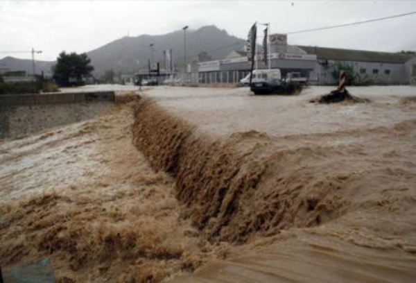
Rambla de Canteras. 09/30/2009. (Cartagena, Murcia)
The Flood Risk Management Plan is the key tool of the European Directive 2007/60/CE relative to the "Evaluation and management of flood risks", which establishes for each Area of significant potential risk of flooding (ARPSI) its flood risk management objectives and, in accordance with each competent Administration, the actions to be carried out.
The Management Plan aims to achieve a coordinated action by all Public Administrations and society to reduce the negative consequences of floods, based on the programs of measures that each of the Administrations must apply within the scope of their powers to achieve the intended goal.
The Segura Hydrographic Confederation, the competent administrations in matters of coasts and the Civil Protection authorities, establish the objectives of flood risk management for each ARPSI, focusing their attention on reducing the potential adverse consequences of flooding for the human health, the environment, cultural heritage, economic activity, and infrastructure.
For public knowledge, the final document, as well as the corresponding environmental documentation, is exposed on this WEB page:
Flood Risk Management Plan
Strategic Environmental Study of the Hydrological Plan and the Flood Risk Management Plan of the Segura Demarcation


