
According to the Hydrological Plan of the demarcation The contributions from the desalination considered for the 2015 scenario correspond to the volumes agreed by the users plus the desalination capacity assigned directly or indirectly to the MCT.
In this way, desalinated resources in the demarcation would reach 158 hm³ / year, of which 96 hm3 / year correspond to irrigation (82 hm³ / year corresponding to IDAMs for public promotion and 14 hm³ in IDAMs private promotion) and 62 hm³ / Year to urban, industrial and service use.
The following figure shows the existing desalination plants in the demarcation.
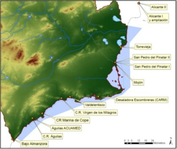
Map of desalination plants considered in the planning process of the Segura hydrographic demarcation
Source: Hydrological Plan of the Segura Demarcation 2015-2021
The Alicante I and II desalination plants are located in Vinalopó-Alacant but supply resources to the MCT. The Bajo Almanzora desalination plant, located in the Mediterranean Hydrographic District of Andalusia, supplies resources to territories located within the Segura river basin.
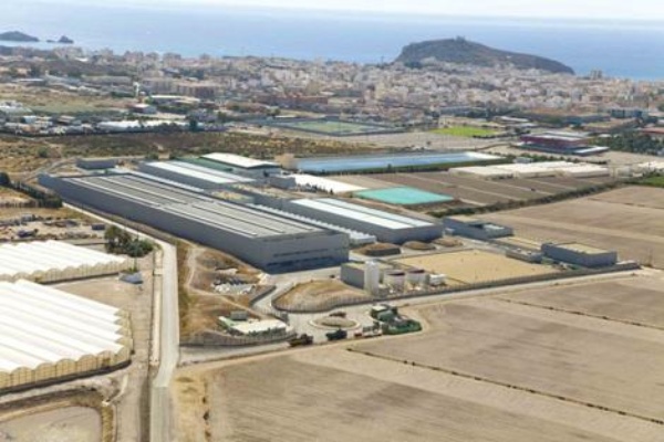
Desalination plant of Águilas
Source: Acuamed
The following table shows the desalinizers and / or desalination considered in the planning process of the Segura hydrographic demarcation and its expected production in each time horizon.
| Horizon 2015 | Horizon 2021 | Horizon 2027 | ||||
|---|---|---|---|---|---|---|
| Desalination plant | Irrigation (hm³) | Urban, Industrial and services (hm³) | Irrigation (hm³) | Urban, Industrial and services (hm³) | Irrigation (hm³) | Urban, Industrial and services (hm³) |
| Alicante I | -58 urban municipalities MCT | -63 urban municipalities MCT | -79 urban municipalities MCT | |||
| Alicante II | ||||||
| San Pedro del Pinatar I | -2 industrial not connected | -2 industrial not connected | -2 industrial not connected | |||
| San Pedro del Pinatar II | -2 golf | -2 golf | -2 golf | |||
| Valdelentisco | 27 | 37 | 37 | |||
| Águilas ACUAMED | 34 | 48 | 48 | |||
| Desaladora de Escombreras (CARM) | 7 | 7 | 7 | |||
| Torrevieja | 5 | 11 | 11 | |||
| El Mojón | 2 | 2 | 2 | |||
| CR Virgen de los Milagros | 10 | 10 | 10 | |||
| CR Marina de Cope | 2 | 2 | 2 | |||
| CR Águilas | 2 | 2 | 2 | |||
| Desaladora del Bajo Almanzora | 7 | 7 | 7 | |||
| TOTAL | 96 | 62 | 126 | 67 | 126 | 83 |
| 158 | 193 | 209 | ||||
Source: Hydrological Plan of the Segura Demarcation 2015-2021


