
The inventory of natural water resources is made up of its quantitative estimation, qualitative description and temporal distribution. It includes the contributions of the rivers and those that feed the natural water, surface and underground storage.
Natural surface water resources
The General Study of the Demarcation 2015-2021, indicates that the natural surface water resources considered are those corresponding to the Segura river at its mouth in Guardamar, and are constituted by the total runoff in natural regime evaluated from the SIMPA Model (Integrated System for Modeling Precipitation-Contribution) developed at the Center for Hydrographic Studies of CEDEX , for the period 1980 / 81-2011 / 12, with an average annual contribution of 740 hm³ / year.
| Zone | Arithmetic mean (hm³ / year) | Maximum (hm³ / year) | Minimum (hm³ / year) | Dev. Typical (hm³ / year) | Coef. Variation |
|---|---|---|---|---|---|
| Guardamar | 740 | 1,462 | 293 | 291 | 0.39 |
| E. from Fuensanta | 218 | 401 | 70 | 87 | 0.4 |
| E. from Talave | 86 | 164 | 29 | 34 | 0.39 |
| Almadenes | 573 | 1,120 | 205 | 221 | 0.39 |
| E. Alfonso XIII | 29 | 101 | 8 | 21 | 0.75 |
| La Esperanza | 23 | 66 | 7 | 16 | 0.67 |
| Calasparra | 515 | 968 | 182 | 190 | 0.37 |
| E. from Cenajo | 346 | 630 | 115 | 129 | 0.37 |
| Argos | 28 | 86 | 10 | 17 | 0.62 |
| Cieza | 598 | 1,166 | 222 | 227 | 0.38 |
| Abarán | 608 | 1,189 | 228 | 231 | 0.38 |
| E. of Bridges | 34 | 115 | 7 | 27 | 0.79 |
| Cañaverosa | 515 | 968 | 182 | 190 | 0.37 |
| Archena | 611 | 1,196 | 229 | 232 | 0.38 |
| E. from La Cierva | 5 | 16 | 1 | 4 | 0.75 |
| Baños de Mula | 14 | 54 | 4 | 11 | 0.83 |
| E. from Valdeinfierno | 12 | 41 | 2 | 10 | 0.86 |
| E. from Camarillas | 131 | 232 | 53 | 45 | 0.34 |
| Passage of the cars | 70 | 209 | 23 | 45 | 0.64 |
| Taibilla | 50 | 87 | 16 | 17 | 0.35 |
| Ojós | 609 | 1,193 | 229 | 232 | 0.38 |
| Beniel | 719 | 1,437 | 281 | 283 | 0.39 |
| Contraparada | 640 | 1,257 | 241 | 245 | 0.38 |
| The Menjú | 598 | 1,167 | 223 | 227 | 0.38 |
| Moratalla | 15 | 47 | 4 | 10 | 0.7 |
Source: Hydrological Plan of the Demarcation of the Segura 2015-2021
The complete series from which this data is obtained can be consulted in the Annex 2 .Inventory of Water Resources (6.1 MB) of the Hydrological Plan of the Segura Demarcation.
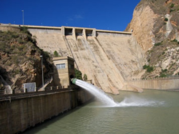
Cenajo Dam (425 hm³ capacity)
Natural groundwater resources
According to the latest available characterization studies, the available groundwater resources are estimated at 540.7 hm³ / year on a year-on-year average value. The sum of the average infiltration of rain, the irrigation returns and the lateral inflows / outflows from other basins minus the environmental reserves have been considered as available resources of the groundwater bodies.
The table below shows the estimated available resources for each of the 63 water bodies considered in the demarcation.
| Code | Name | Total resources | Environmental reserves | Available resources |
|---|---|---|---|---|
| 70.001 | CORRAL RUBIO | 2,1 | 1.92 | 0.18 |
| 70.002 | LA HIGUERA SINCLINAL | 3.1 | 0.23 | 2.87 |
| 70.003 | ALCADOZO | 9 | 1.71 | 7.29 |
| 70.004 | BOQUERÓN | 15.1 | 0 | 15.1 |
| 70.005 | TOBARRA-TEDERA-PINILLA | 5.3 | 0 | 5.3 |
| 70.006 | PINO | 1.03 | 0.92 | 0.11 |
| 70.007 | CONEJEROS-ALBATANA | 2,68 | 0 | 2.68 |
| 70.008 | ONTUR | 3.1 | 0 | 3.1 |
| 70.009 | SIERRA DE LA OLIVA | 1 | 0 | 1 |
| 70.010 | JURASSIC FOLDS OF THE WORLD | 90.68 | 35.99 | 54.69 |
| 70.011 | KNIVES-GOATS | 5,7 | 0.5 | 5.2 |
| 70.012 | CINGLA | 8,59 | 0 | 8.59 |
| 70.013 | MORATILLA | 0.5 | 0 | 0.5 |
| 70.014 | CALAR DEL MUNDO | 12.7 | 2.69 | 10.01 |
| 70.015 | SEGURA-MADERA-TUS | 37.37 | 15.26 | 22.11 |
| 70.016 | FUENTE SEGURA-FUENSANTA | 107.43 | 39.29 | 68.14 |
| 70.017 | LOWER AQUIFERS FROM SIERRA DEL SEGURA | 0 | 0 | 0 |
| 70.018 | MACHADA | 0.5 | 0.05 | 0.45 |
| 70.019 | TAIBILLA | 9.5 | 1,28 | 8.22 |
| 70.020 | ANTICLINAL DE SOCOVOS | 49.95 | 8.54 | 41.41 |
| 70.021 | EL MOLAR | 3.1 | 0.82 | 2.28 |
| 70.022 | CALASPARRA SINCLINAL | 12 | 1.64 | 10.36 |
| 70.023 | JUMILLA-YECLA | 6 | 0 | 6 |
| 70.024 | LACERA | 0 | 0 | 0 |
| 70.025 | ASCOY-SOPALMO | 1,6 | 0 | 1.6 |
| 70.026 | EL CANTAL-VIÑA PI | 0.08 | 0 | 0.08 |
| 70.027 | SERRAL-SALINAS | 1,8 | 0 | 1.8 |
| 70.028 | BAÑOS DE FORTUNA | 2 | 0.49 | 1.51 |
| 70.029 | QUIBAS | 0.76 | 0.74 | 0.02 |
| 70.030 | SIERRA DEL ARGALLET | 0 | 0 | 0 |
| 70.031 | SIERRA DE CREVILLENTE | 0 | 0 | 0 |
| 70.032 | CARAVACA | 41.55 | 4.37 | 37.18 |
| 70.033 | UNDER CHIP | 3,54 | 0.64 | 2.9 |
| 70.034 | ORO-RICOTE | 1,29 | 0.1 | 1.19 |
| 70.035 | QUATERNARIO DE FORTUNA | 0.2 | 0.2 | 0 |
| 70.036 | VEGA MEDIA Y BAJA DEL SEGURA | 40.9 | 9,14 | 31.76 |
| 70.037 | SIERRA DE LA ZARZA | 2,4 | 0.1 | 2.3 |
| 70.038 | ALTO QUÍPAR | 3,24 | 2.02 | 1.22 |
| 70.039 | BULLAS | 13.92 | 1.16 | 12.76 |
| 70.040 | SIERRA ESPUÑA | 12.73 | 3.9 | 8.83 |
| 70.041 | VEGA ALTA DEL SEGURA | 8.9 | 0.05 | 8.85 |
| 70.042 | TERTIARY OF TORREVIEJA | 1,24 | 0.33 | 0.91 |
| 70.043 | VALDEINFIERNO | 4.77 | 1.02 | 3.75 |
| 70.044 | VELEZ BLANCO-MARIA | 7,8 | 0 | 7.8 |
| 70.045 | DETRÍTICO DE CHIRIVEL-MALÁGUIDE | 3.1 | 0.5 | 2.6 |
| 70.046 | BRIDGES | 2.04 | 0.13 | 1.91 |
| 70.047 | TRIASSIC MALAGUID OF SIERRA ESPUÑA | 0,4 | 0 | 0.4 |
| 70.048 | SANTA-YÉCHAR | 2,4 | 0 | 2.4 |
| 70.049 | ALEDO | 1.78 | 0 | 1.78 |
| 70,050 | BAJO GUADALENTÍN | 11 | 0 | 11 |
| 70.051 | CRESTA DEL GALLO | 0.66 | 0 | 0.66 |
| 70.052 | CARTAGENA FIELD | 95.2 | 6.21 | 88.99 |
| 70.053 | CABO ROIG | 1,4 | 0.36 | 1.04 |
| 70.054 | TRIASSIC OF VICTORY | 3,3 | 0 | 3.3 |
| 70.055 | TRIÁSICO DE CARRASCOY | 3,9 | 0 | 3.9 |
| 70.056 | SIERRA DE LAS ESTANCIAS (2) | 0.05 | 0 | 0.05 |
| 70.057 | ALTO GUADALENTÍN | 11.5 | 0 | 11.5 |
| 70.058 | MAZARRÓN | 3.53 | 0.03 | 3.5 |
| 70.059 | ENMEDIO-CABEZO DE JARA | 0.5 | 0 | 0.5 |
| 70.060 | LAS NORIAS | 0 | 0 | 0 |
| 70.061 | EAGLES | 7.17 | 1.49 | 5.68 |
| 70.062 | SIERRA DE ALMAGRO | 1 | 0 | 1 |
| 70.063 | SIERRA DE CARTAGENA | 0.63 | 0.16 | 0.48 |
| Total | 684,7 | 144 | 540,7 |
Source: Hydrological Plan of the Demarcation of the Segura 2015-2021


