
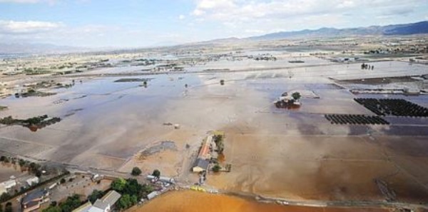
Guadalentín Valley. Flood of Saint Wenceslas. 09/28/2012 (Lorca. Murcia)
THIRD PLANNING CYCLE 2028-2033
In compliance with the mandate established in the Directive 2007/60/EC, transposed to the Spanish legal order by means of the Royal Decree 903/2010, of 9 July, of evaluation and management of flood risks, the Hydrographic Confederation of the Segura (CHS) has carried out the This review has counted on the collaboration of the Civil Protection Services of the Autonomous Communities of the field of demarcation and of the General Administration of the State. Also, the evaluations carried out by the General Directorate of the Coast and the Sea of the Ministry for the Ecological Transition and the Demographic Challenge have been considered, with regard to the ARPSI of marine origin.
As a result of the work carried out, 10 new ARPSI sections have been incorporated, some of them as extension of already existing sections, motivated by the occurrence of significant flooding episodes during the previous cycle. With this update, the total number of river or river-rain ARPSI sections in the Segura Hydrographic Demarcation is increased from 153 to 163, which means a total length of 625.9 km of gully with significant potential risk.
Additionally, a hazard and risk analysis of the ARPSI sections identified in the second cycle has been carried out, based on the information contained in the current Flood Risk Management Plan, in order to assess the possible elimination of those sections with lower level of risk. After this analysis, the exclusion of any of them has not been contemplated, given the existence of historical references of river floods with proven damages.
The document resulting from this update has been subjected to public consultation (BOE no. 212, of 2 September 2024), and the final approval has been carried out by means of Resolution of the Secretariat of State for the Environment (Resolution of 4 June 2025, of the Secretariat of State for the Environment, approving the review and updating of the preliminary flood risk assessment of intercommunity hydrographic demarcations).
For your knowledge and consultation, the complete documentation related to the Preliminary Flood Risk Assessment of the third cycle in the Segura Hydrographic Demarcation.
La delimitació de les Àrees de Risc Potencial Significatiu d'Inundació (ARPSI) revisada i actualitzada corresponent al tercer cicle es pot descarregar en:
SECOND PLANNING CYCLE 2022-2027
In accordance with section 1 of article 21 of Royal Decree 903/2010, of July 9, on the Evaluation and Management of Flood Risks,, the preliminary flood risk assessment will be updated no later than December 22, 2018, as continuation every six years.
For this purpose, the documentation of the review and update of the Preliminary Flood Risk Assessment corresponding to the second planning cycle of flood risk management of the Segura River Basin District is exposed on this WEB page, once the term has expired. of public consultation ((BOE no. 188, August 4, 2018), and the review and update approved by Resolution of the Secretary of State for the Environment ((BOE no. 126, of May 27, 2019).
Following the revision and update done, has remained the 43 ARPSIs demarcation, 22 transitional river and coastal and 21, to expand the number of sections of ARPSI river or fluvio-pluviales of 148-153 tranches, thus making a total of 571,84 km of track. The details are available on the following documentation.
- Memory (9.6 MB)
- Annex Nº1. Plans (42 MB)
- Annex Nº2. Historical episodes (1,7 MB)
- Annex Nº3. ARPSI (93 MB)
- Annex Nº4. EPRI 1º cycle (152 MB)
FIRST PLANNING CYCLE 2016-2021
In compliance with the mandate established in Directive 2007/60/CE, ttransposed into our legal system by Royal Decree 903/2010, of July 9, on the Evaluation and Management of Flood Risks, the Segura Hydrographic Confederation (CHS), In 2010, with the collaboration of the Civil Protection Services of the Autonomous Communities and the General State Administration, it carried out a preliminary assessment of the risk of flooding in the area of the Segura River Basin District, in order to identify the areas with the highest flood risk, known as Areas of Significant Potential Risk of Flooding (ARPSI).
On the other hand, the General Directorate of Sustainability of the Coast and the Sea of the Ministry of Agriculture, Food and Environment, has also carried out the evaluation of the risk of flooding caused by the sea in coastal areas, thus identifying the ARPSI of marine origin.
The result of both works, synthesized in the document called "Preliminary evaluation of the risk of Flooding in the Segura River Basin District. Report and annexes", was submitted to public consultation for a period of fifteen days through its presentation on the website of the CHS, in accordance with the abbreviated administrative procedure provided for in the First Transitory Provision of the aforementioned Royal Decree, and favorably informed by the National Civil Protection Commission prior to its submission to the European Commission.
For public knowledge, the definitive documentation of the first cycle is exposed on this WEB page:
- Memory (783 KB)
- Annex Nº 1 Treatment of information and preselection of risk areas (5.4 MB)
- Appendix No. 1. Plans (271 MB)
- Appendix Nº 2. List of historical floods (72 KB)
- Appendix No. 3. ARPSI. Tabs and graphic informatio (339 MB)
- Preliminary assessment of flood risks and selection of areas with significant potential risk in coastal zones (7 MB)


