
The acronym WMS stands for "Web Map Service". It is a standard for publishing cartography on the Internet and its specifications are collected by the international organization OGC (Open Geospatial Consortium). WMS is a service and not a web page, so it must be used from a GIS (Geographic Information System) program or viewer that supports this type of service.< /p>
The acronym WMTS stands for "Web Map Tile Service". In this case, the maps have predetermined scale levels, and thanks to this they are much faster and more efficient for the web. It is necessary to use a GIS capable of understanding this system, a standard since 2010.
The mapping layers offered in the WMS and WMTS standards can be used in several ways. shapes. If you have a specific computer program (GIS), available with both free and commercial license, you can get the most out of these services. They can also be used on other web browser-based systems. The addresses of the web services (see table) are used in the GIS to obtain the layers in image format; These can be superimposed depending on the needs of use. For information on GIS programs you can consult an updated list on Wikipedia.
| Resource | Service WMS | Service URL | Layers |
|---|---|---|---|
 |
Basic layers | Theme layer WMS service |
|
| Resource | Service WMTS | Service URL |
|---|---|---|
 |
Ortofotos históricas |
Partial orthophoto of the Ruiz de Alda flight in 1929 (More information</a >) |
|
Orthophoto American flight of 1956 ( See more information) |
||
|
GEOFASA orthophoto from 1969 |
||
|
Orthophoto interministerial flight of 1977 |
||
 |
Recent orthophotos |
Orthophoto year 1987 |
|
Oleícola 1997 |
||
|
Orthophoto year 1999 |
||
|
FEGA/SIGPAC 2002 |
||
|
PNOA 2004 |
||
|
PNOA 2007 |
||
|
PNOA 2009-2011 |
||
|
PNOA 2012-2013 |
||
|
PNOA 2016 (Murcia) |
||
|
PNOA 2017 (C. Valenciana) |
||
|
PNOA 2018 (C.Valenc/C.L.M.) |
||
|
PNOA 2019 (Murcia/Andalucía) |
||
|
PNOA 2021 (C.Valenc/C.L.M.) |
||
|
PNOA 2022 (Murcia/Andalucía) |
||
|
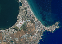
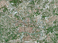
PNOA 2024-2025 (Murcia - Rest) |
||
 |
Satellite Images |
Landsat 1984 |
|
Landsat 1990 |
||
|
Landsat 1995 |
||
|
SPOT 2005 |
||
|
SPOT 2008 |
||
|
SPOT 2012 |
||
|
SENTINEL 2016 |
||
|
SENTINEL 2018 |
||
|
SENTINEL 2021 |


