
Note: From the attributes table of the viewer itself, the piezometer data can be exported to CSV format (text separated by commas)
In the Hydrological Plan of the Segura Basin, 57 hydrogeological units (UH) of groundwater are defined, of which 40 are located entirely within our basin. The remaining 17 are constituted as inter-basins, since they have a part of their surface, located in the geographical area of the neighboring basins of the Guadalquivir (7 of them), the South (3) or the Júcar (7). The number of existing aquifers in the Segura basin (some also inter-basins for the same reason) amounts to a total of 234.
With the implementation of the Water Framework Directive, all the groundwater bodies in the Basin have been identified. This action has been carried out based on the delimitation of the Hydrogeological Units and aquifers that are defined in the Basin Hydrological Plan.
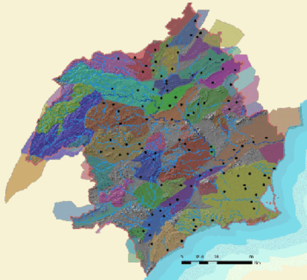
Mapa de la red piezométrica
The piezometric control network is currently made up of more than 130 control points, distributed among the different groundwater bodies in the basin. The measurement of the piezometric level in each mass is made from the verification of the depth to which the water is found, in some of the existing soundings.
For the selection of the control points where the measurement is made, those sites that are considered most significant of the overall behavior of the water body have been chosen. The spatial density of piezometers necessary to follow its evolution is not totally uniform throughout the basin. Depending on the geographical scope defined for each body of water, a measurement is carried out on them ranging from exclusively a single piezometer in those with the smallest surface area, to eleven piezometers in the largest area.
Among the water bodies that have a greater number of control points are those where most of the groundwater withdrawals from the Segura basin are located, such as those of Campo de Cartagena, Caravaca , Vegas Baja y Media del Segura, Socovos Anticlinal, Alto Guadalentín, Bajo Guadalentín, Ascoy-Sopalmo, Boquerón, Bullas, El Molar, Mazarrón, Jurassic Folds of the World, Cuchillos-Cabras, Sierra Espuña, Cingla, Águilas and Sinclinal de Calasparra .
Many of the points that make up the network have been previously managed by different public bodies, in some cases since the early 1970s and generally and more continuously since the 1980s. As it is a network based on private wells and boreholes, it is necessary to carry out continuous monitoring of the state of these, incorporating new ones that are replacing others that are rendered useless by various causes. This problem has motivated that at present and by order of the Ministry of Agriculture, Food and Environment, this Confederation executes construction works and conditioning of its own piezometer-soundings, located in plots owned by the State, so that all Verifications of the piezometric level of the water bodies, which in the future it will be necessary to carry out.
For the selection of new points to replace the existing ones and those made by this Agency, the criterion of trying to give continuity to the historical series is maintained, as a way of guaranteeing knowledge of the quantitative evolution over time, of the groundwater resources in the Segura hydrographic basin.
Piezometric network monthly report
The last monthly reports related to the piezometric network correspond to April 2016 and are as follows:


