
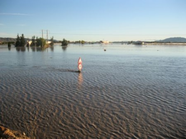
Valle del Guadalentín. Riada de San Wenceslao. 28/09/2012. (Lorca. Murcia)


SECOND PLANNING CYCLE 2016-2021 (IN PUBLIC CONSULTATION)
In accordance with article 21.2 of the Royal Decree 903/2010, flood hazard maps and flood hazard maps will be reviewed and, if necessary, updated no later than December 22, 2019 and every six years thereafter. For this reason, and in accordance with article 10 of the aforementioned Royal Decree, hazard and risk maps are subject to public consultation for a period of three months, starting on August 1, 2019. (BOE núm. 183, of 1 August 2019). Only the new ARPSI sections and those of the first cycle that have been modified are included in the downloadable files below..
At the end of this period, they must be informed by the Committee of Competent Authorities of the Segura Hydrographic Demarcation, so that, if applicable, they are subsequently sent to the Ministry for Ecological Transition for incorporation into the National System for Cartography of Floodplains..
FLOODS OF RIVER ORIGIN (sections ARPSI)
The following can also be consulted:
- "Methodological Guide for the development of the National System of Flood Zones Cartography (SNCZI), Preliminary Risk Assessment", of the Ministry of Agriculture, Food and Environment
- “Proposal of minimums for the realization of flood risk maps. Flood Directive - 2nd cycle. June 2019 ”, from the Ministry for Ecological Transition
Hazard maps of river flooding in ARPSI
Downloads in format SHP:
Flood drafts river flooding in ARPSI
Raster format downloads:
| Section name ARPSI | Section code ARPSI | Municipality | Raster format |
|---|---|---|---|
| Río Segura (Ceutí) | ES070/0006-20 | Alguazas, Ceutí, Lorquí, Molina de Segura y Las Torres de Cotillas |  (24 MB) (24 MB) |
| Sin Nombre (La Torre Golf y Terrazas La Torre) | ES070/0012-12 | Torre-Pacheco | (8 MB) |
| Rambla de Los Aznares | ES070/0015-08 | Mazarrón | (1 MB) |
| Ampliación Rambla de Benipila | ES070/0016-04 | Cartagena | (503 KB) |
| Rambla del Portús | ES070/0016-05 | Cartagena | (828 KB) |
| Cañada de Morcillo | ES070/0006-10 | Molina de Segura | (8 MB) |
| Rambla de las Monjas | ES070/0006-11 | Molina de Segura | (6 MB) |
| Rambla del Salar Gordo | ES070/0006-13 | Lorquí | (8 MB) |
| Cañada de Mendoza | ES070/0006-14 | Molina de Segura | (6 MB) |
| Rambla de las Salinas | ES070/0006-15 | Molina de Segura | (7 MB) |
| Rambla del Chorrico | ES070/0006-16 | Molina de Segura | (8 MB) |
| Rambla de las Canteras | ES070/0006-17 | Molina de Segura | (7 MB) |
| Rambla de la Casa del Aire | ES070/0009-02 | Murcia | (11 MB) |
| Rambla de Barnuevo | ES070/0009-03 | Murcia | (9 MB) |
| Rambla de Churra | ES070/0009-04 | Murcia | (10 MB) |
| Rambla del Puerto | ES070/0009-11 | Murcia | (9 MB) |
| Sin nombre | ES070/0009-12 | Murcia | (9 MB) |
| Rambla del Valle | ES070/0009-13 | Murcia | (9 MB) |
| Rambla del Valle | ES070/0009-14 | Murcia | (11 MB) |
| Barranco del Sordo | ES070/0009-15 | Murcia | (13 MB) |
| Sin nombre | ES070/0012-03 | Murcia | (2 MB) |
| Sin nombre | ES070/0012-04 | Murcia | (3 MB) |
| Rambla de la Maraña | ES070/0013-02 | Torre-Pacheco y Los Alcázares | (14 MB) |
| Rambla de Calarreona | ES070/0014-01 | Águilas | (732 KB) |
| Sin nombre | ES070/0016-01 | Cartagena | (540 KB) |
| Rambla de Canteras | ES070/0016-02 | Cartagena | (687 KB) |
| Rambla de Benipila | ES070/0016-04 | Cartagena | (504 KB) |
| Rambla de Canalejas o de Canales | ES070/0021-05 | Cuevas de Almanzora | (6 MB) |
Fluvial flood risk maps in ARPSI
Given the magnitude of the information that needs to be handled, the public consultation process for the review and update of the flood risk maps of the Segura River Basin District is carried out in two phases.
Phase I. Fluvial flood risk maps in ARPSI sections identified in the review and update of the Preliminary Flood Risk Assessment or in sections in which it has been considered necessary to review and / or update them, in compliance with article 21 of the Royal Decree 903/2010.
Descargas en formato SHP:
Fase II. Fluvial flood risk maps in ARPSI stretches where it has not been considered necessary to review and / or update them. These maps are modified according to changes in the methodology included in the “Proposal of minimums for the realization of flood risk maps. Flood Directive - 2nd cycle. June 2019 ”, from the Ministry for Ecological Transition.
Downloads in format SHP:
Delimitations and protection zones in ARPSI
Downloads in format SHP:
FLOODS OF MARINE ORIGIN IN ARPSI
In relation to the maps of danger and risk of flooding caused by the sea in coastal and transitional waters, in accordance with article 10.1 of Royal Decree 903/2010 on evaluation and management of flood risk, it is the General Directorate of Sustainability of the Coast and the Sea of the Ministry for Ecological Transition, the competent body for the preparation of this information.
As long as the databases that were used for the preparation of said maps during the implementation of the first cycle of the Directive are not modified, the maps already published in the National System for Floodplain Cartography will be maintained. It is planned in the future to update these databases with the projections of the Fifth IPCC Report (AR5) in order to include the fundamental statistical data of the new projections, improving the quality of the starting data, which will allow in turn, obtain results with better performance in terms of regionalization of results and precision of sea level..
This information from the new projected sea level and wave variables will be used to, using the iOLE methodology, review the flood level along 33,000 topo-bathymetric profiles covering the entire Spanish coast. The comparison between the distribution of the new projected flood level and the historical one in each profile will be used to evaluate the possible repercussions of climate change on the incidence of floods in the review and update of the flood risk management plans, in accordance with Article 21.4 of the Royal Decree 903/2010.
For questions or clarifications Customer servicesegura@chsegura.es
FIRST PLANNING CYCLE 2010-2015
In accordance with articles 8, 9 and 10 of the Royal Decree 903/2010, For each Area of Significant Potential Risk of Flooding (ARPSI), flood hazard maps (calculation of the flood zone and its drafts) and flood risk (incorporation of the land uses in that area into the flood zone) have been drawn up. and the main expected damages).
Likewise, in accordance with article 10 of the aforementioned Royal Decree, the hazard and risk maps were submitted to public consultation for a period of three months, and were favorably reported by the Committee of Competent Authorities of the Segura River Basin District. Later they were sent to the Ministry of Agriculture, Food and Environment for incorporation into the National System of Cartography of Floodplains. A summary of the main conditions was also sent to the European Commission.
For public knowledge, the definitive documentation is exposed on this WEB page:
FLOODS OF RIVER ORIGIN IN ARPSI
River flood hazard maps in ARPSI
Downloads in format SHP:
- Floodplains of fluvial origin with T = 10 years. (147 MB)
- Flood zones of fluvial origin with T = 100 years. (250 MB)
- Floodplains of fluvial origin with T = 500 years. (282 MB)
URL of the services WMS:
Flood zones
- http://www.chsegura.es/chswmsserver/ZI_ARPSI_T10
- http://www.chsegura.es/chswmsserver/ZI_ARPSI_T100
- http://www.chsegura.es/chswmsserver/ZI_ARPSI_T500
Drafts in flooded areas
- http://servicios.idee.es/wms-inspire/riesgos-naturales/inundaciones
Fluvial flood risk maps in ARPSI
The service WMS includes the following layers:
- Risk to the population (T = 10, 100 and 500 years)
- Risk to economic activities (T = 10, 100 and 500 years)
- Risk at points of special importance (T = 10, 100 and 500 years)
- Areas of Environmental Importance (T = 10, 100 and 500 years)
Service url WMS: http://www.chsegura.es/chswmsserver/ZI_ARPSI_DELIMITACIONESyRIESGO_FLUVIAL
Delimitations and protection zones
Downloads in format SHP:
The service WMS includes the following layers (in addition to risk maps):
- Delimitation of ARPSIs
- Preferential flow zone
- DPH cartographic, Easement Zone and Police Zone
Service url WMS: http://www.chsegura.es/chswmsserver/ZI_ARPSI_DELIMITACIONESyRIESGO_FLUVIAL
FLOODS OF MARINE ORIGIN IN ARPSI
Maps of danger and risk of flooding of marine origin in ARPSI
Downloads in format SHP:
A service is offered WMS which includes the following layers:
- Zonas inundables de origen marine with T = 100 and 500 years
- Risk to the population (T = 100 and 500 years)
- Risk to economic activities (T = 100 and 500 years)
- Risk in points of special importance (T = 100 and 500 years)
- Areas of Environmental Importance (T = 100 and 500 years)
Service url WMS: http://www.chsegura.es/chswmsserver/ZI_ARPSI_RIESGO_MARINO
Drafts in flooded areas (T = 100 and 500 years) can be consulted in the following services WMS
- http://servicios.idee.es/wms-inspire/riesgos-naturales/inundaciones


