
On this page you can consult the information regarding the final document and the process followed for the revision of the Hydrological Plan of the Segura river basin district for the 2015/21 horizon.
The definitive documents corresponding to each one of the stages of elaboration of the Plan, the reports evacuated and the contributions received in the different periods of public consultation are made available.
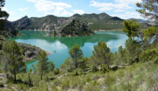
Embalse de la Fuensanta. Abril de 2012. (Autor: Antonio Callejas Gallar)
Hydrological Plan of the Segura river basin district 2015-2021
By Royal Decree 1/2016, of January 8 (BOE of January 19, 2016) , the revision of the Hydrological Plans of the hydrographic demarcations of the Western Cantabrian, Guadalquivir, Ceuta, Melilla, Segura and Júcar, and the Spanish part of the eastern Cantabrian, Miño-Sil, Duero, Tajo, Guadiana and Ebro river basin districts.
Previously and by Resolution of September 7, 2015, of the Secretary of State for the Environment , a joint strategic environmental statement of the Hydrological and Hydrological plans had been formulated. of Flood Risk Management of the Segura River Basin District for the period 2015-2021.
The complete documents of the approved Plan and the strategic environmental study are available at the following links.
Public consultation of the Hydrological Plan Project
On September 3, 2015, the Water Council of the Segura Demarcation favorably informed the Draft Hydrological Plan of the Segura Hydrographic Demarcation 2015/21 and agreed with the agreement of the Committee of Competent Authorities its elevation to the Government, for approval, through the Ministry of Agriculture, Food and Environment.
A proposal of the aforementioned Draft Plan, prepared in accordance with the Outline of Important Issues in the field of water management, had previously been submitted to public consultation by Resolution of 30 of December 2014 of the General Directorate of Water announcing the opening of the period of consultation and public information of the documents entitled "Proposal for a project to review the Hydrological Plan, Draft Flood Risk Management Plan and Strategic Environmental Study "corresponding to the hydrographic demarcations of the western Cantabrian, Guadalquivir, Ceuta, Melilla, Segura and Júcar and to the Spanish part of the eastern Cantabrian hydrographic demarcations, Miño-Sil, Duero, Tajo, Guadiana and Ebro.
The contributions received both to the proposed Draft Plan and to its Strategic Environmental Study, which served to improve the documents submitted to public consultation, are included below.
The reports then evaluated are as follows.
Public consultation of the Outline of Important Demarcation Topics
The Outline of Important Issues in the area of water management in the demarcation was favorably informed by the Demarcation Water Council at its meeting on September 29, 2014.
This report completed a stage of public participation agreed by Resolution of December 30, 2013 of the General Directorate of Water announcing the opening of the public consultation period of the documents entitled "Provisional Scheme of Important Issues" of the hydrological planning process (revision 2015) corresponding to the hydrographic demarcations of the western Cantabrian, Guadalquivir, Ceuta, Melilla, Segura and Júcar and to the Spanish part of the river basin districts of the eastern Cantabrian, Miño-Sil, Duero, Tajo, Guadiana and Ebro.
For six months, interested parties, institutions and individuals were able to make contributions to the provisional document. The analysis and consideration of the contributions allowed the preparation of the final document.
The final document is accessible at the following links and contained the description and assessment of the main current and foreseeable problems of the demarcation related to water and possible alternatives for action.
The contributions and reports evacuated during this phase are included below.
Public consultation of the Program, Calendar, General Study of the Demarcation and Formulas of consultation of the planning process 2015-2021
In accordance with the twelfth additional provision of the consolidated text of the Water Law, the General Directorate of Water in the BOE of May 24, 2013, published the opening announcement of the public consultation period of the documents "Program, Calendar, General Study on the Demarcation and Consultation Formulas", with which the process of hydrological planning 2015-2021 began in the hydrographic demarcations of the western Cantabrian, Guadalquivir, Ceuta, Melilla, Segura and Júcar and in the Spanish part of the river basin districts of the eastern Cantabrian, Miño-Sil, Duero, Tajo, Guadiana and Ebro.
The final documents corresponding to the Segura Hydrographic Demarcation are indicated below:
The contributions received during this procedure are those included below:
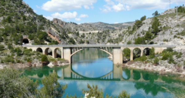
Cola del Embalse de Fuensanta. Puente de la carretera a Yeste. (Yeste. Albacete)


