
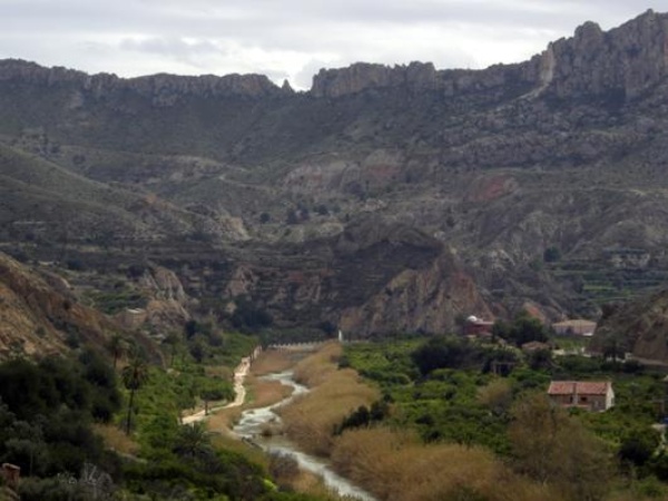
White Stream. Nerpio
Physical frame
The Segura demarcation is almost entirely within the geological domain of the Betic Cordilleras. Only in its northern part are there materials from the tabular cover that conceal the oldest areas of the Hercinian plinth of the Plateau, which in turn constitute the base of the Betic complex. The Betic Cordilleras correspond to the whole of the mountain chain generated by alpine folding that extends through Andalusia, Murcia and South of Valencia.
Topographically the Segura demarcation is a territory of a great orographic variety, distinguishing the head areas with mountains with maximum levels above 2,000 m and the areas near the coast with extensive plains.
Hydrogeologically, this complexity gives rise to the existence of numerous aquifers of medium and small extension, with frequently complex and tormented geological structures that contribute appreciably to the maintenance of the natural flows of the rivers.
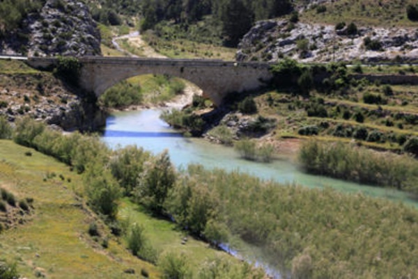
Ricote Valley
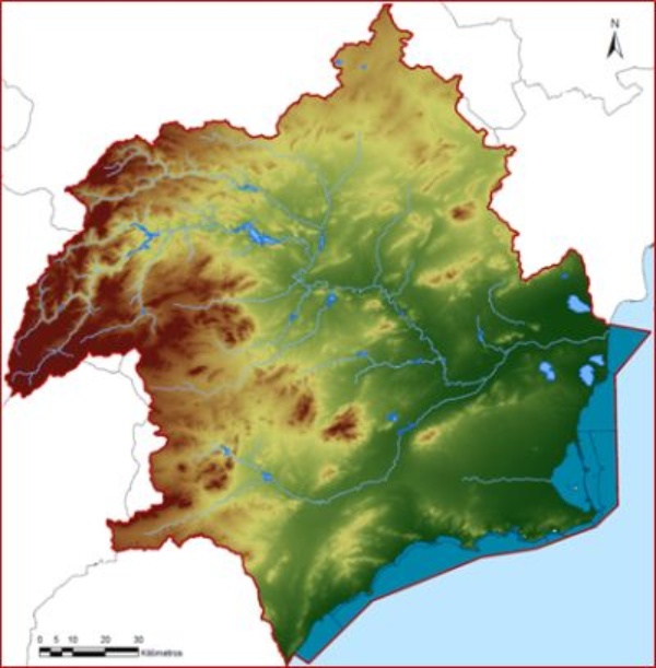
Digital Terrain Model with 100x100 resolution
For more information you can see
Source: Hydrological Plan of the Segura Demarcation 2015-2021
Climatic Characteristics
In general, the climate predominantly in the Segura river basin corresponds to the Mediterranean, with particular typologies in the different areas that comprise it.
Specifically, half of the Segura river basin district, which runs from the headwaters of the Guadalentín river through the northwestern sierras, continuing through Corral-Rubio, to go down through Yecla to the Sierra del Carche, have a temperate Mediterranean climate .
The continental Mediterranean climate occupies two well differentiated and close areas. The first is located in the Turrilla river, south of the Sierra de Ponce or Cambrón and head of the Pliego river. The second zone, starting from the Cierva reservoir, passes through the lower part of the stream of Las Murtas, half of the Rambla del Judío, Fortuna and the weir of Ojós.
The subtropical Mediterranean climatic type is the second in terms of extension, ranging from the limits of the previous ones to the coast, except for a strip that goes from the surroundings of Águilas to Cabo Tiñoso, passing through Mazarrón, which corresponds to the climate semi-arid subtropical Mediterranean.
The average annual rainfall in the area is about 382 mm, according to the historical resource series (1940 / 41-2005 / 06) and 362 mm according to the short series (1980 / 81-2005 / 06), characterized by a rainfall regime with large spatio-temporal imbalances and a clear contrast between the head areas: Mundo and Segura until their confluence, and the lower and middle parts of the basin: Vegas and coastal areas.
The average potential evapotranspiration is of the order of 700 mm and an estimated real mean evapotranspiration of 328 mm, for the historical series. The total average runoff is of the order of 13% of the total average precipitation (historical series), being the lowest on the peninsula.
You can consult and download the climatic data and series associated with the main meteorological stations of the basin, in
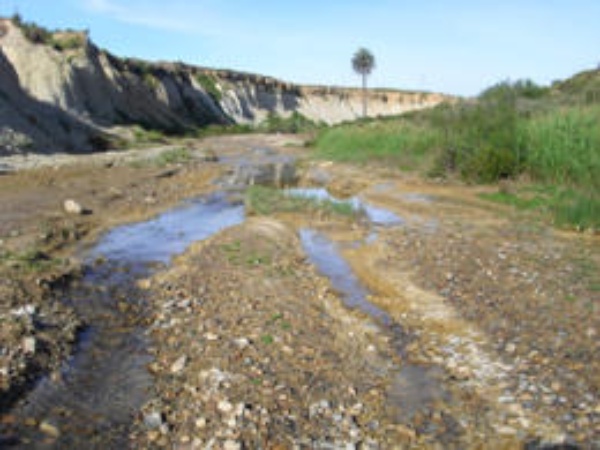
Rambla del Reventón
You can expand information on the climatic characteristics of the Segura demarcation, in the following sections:
Rainfall
In the Segura river basin district, according to data from SIMPA , average annual total precipitation values of around 381.78 mm have been recorded (series from 1940 to 2011), oscillating between the maximum value of 608.6 mm in 1988 and the minimum value of 212.7 mm in 1963.
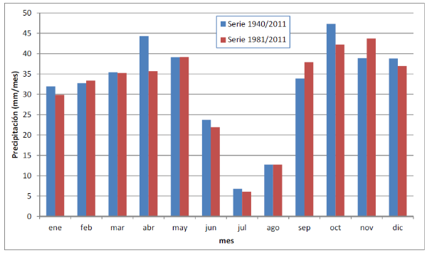
Intra-annual distribution of total annual precipitation (mm / year) in the < abbr title = "Segura Hydrographic Demarcation"> DHS (data on weather stations)
Source: Segura Basin Hydrological Plan 2015-2021
The intra-annual and spatial distribution of these precipitations is characterized by its wide heterogeneity, with quite rainy months (mainly the months of autumn and spring) and dry months (summer).
Regarding the spatial distribution of these precipitations, it is in the mountains located in the northwest of the basin, subjected to the action of the humid winds of the Atlantic storms of the polar front, where the pluviometric records reach their maximum values, exceeding more than 1,000 mm / year.
On the other hand, the low average annual precipitation in the Águilas depression stands out, closed by the Carrasquilla, La Almenara and Lomo de Bas reliefs, where the average volume of precipitation is of the order of 200 mm / year and even lower . In these cases, the hidden forms of precipitation (dew condensation) and the high humidity of the coastal areas must be considered.
As exceptions to this general rain distribution scheme are Sierra Espuña, with values somewhat higher than 500 mm and a wide area located near the Hellín-Jumilla-Fortuna-Cieza estate, where the average annual rainfall is equal or less than 300 mm / year.
A characteristic feature regarding the rainfall of the demarcation is the existence of episodes of heavy rains, a phenomenon known as "cold drop", characterized by short and very intense rainfall, causing large avenues with a marked torrential character. This phenomenon takes place mainly in the autumn months.
In this regard, the CHS has carried out an assessment and identification in its territorial scope of areas with a significant potential flood risk, in accordance with the provisions of European Directive 2007/60 / EC on the "Assessment and management of flood risks". You can expand information on the following link:
On the other hand, drought episodes are also frequent in the summer months, with practically zero rainfall, as well as interannual drought periods.
The most severe periods of drought and those with the greatest socio-economic impact of the Segura district were those that occurred in the periods 1980-1983, 1990-1995 and 2005-2009.
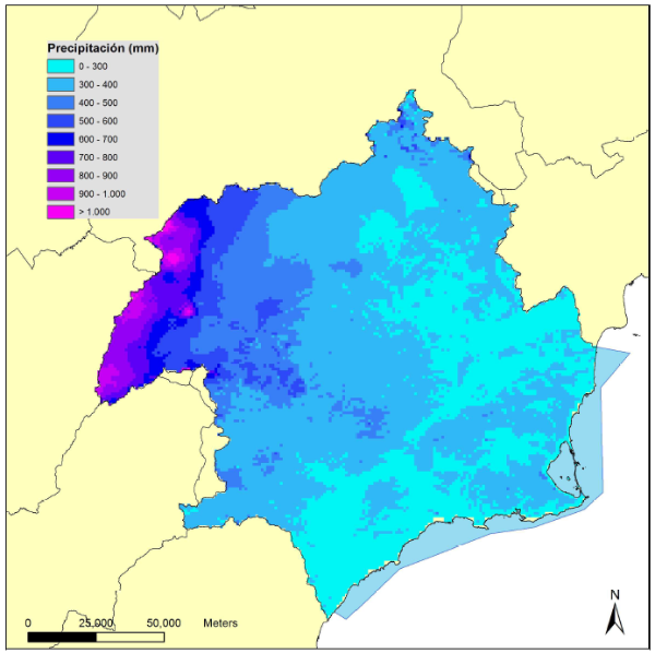
Spatial distribution of total annual precipitation (mm/year) in the demarcation hydrographic of the Segura. (Period 1980-2011)
Source: Segura Basin Hydrological Plan 2015-2021
You can consult the management that the Segura Hydrographic Confederation carries out of the drought episodes of the demarcation, in the DROUGHTS section of the CHS .
You can consult the following precipitation data in the demarcation:
- Historical Monthly Precipitation
 (29 KB)
 - Accumulated Monthly Precipitation in the last 5 years (15 KB)
- Average accumulated precipitation at the head of the last 5 years (15 KB)
- Average annual precipitation in the Segura basin (18 KB)
- Average annual precipitation at the head of the Segura basin (17 KB)
Temperature
The annual temperature regime presents a winter minimum in the months of December and January, with the lowest values being more frequent in this period. The annual maximums correspond to the months of July and August although, in general, the first one is somewhat warmer.
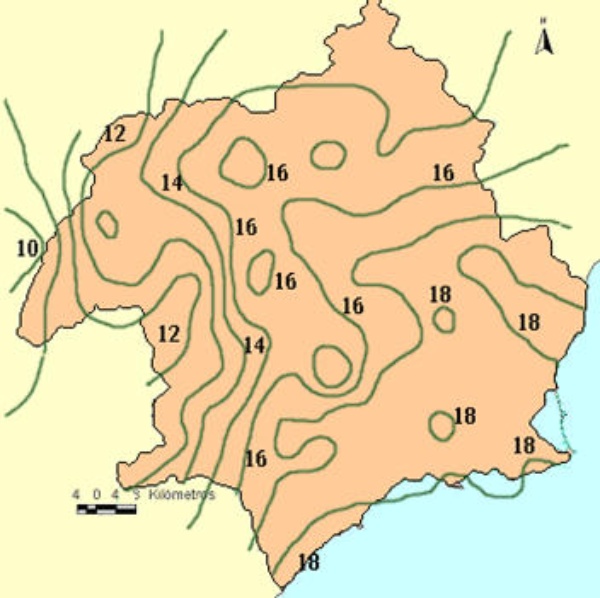
The lowest temperatures in the Segura river basin occur in the northwestern ranges. From these mountains and descending towards the coast, the annual average temperature increases, reaching 18ºC. Exceptions to this general scheme are, on the one hand, Sierra Espuña, where the average annual temperature drops to 14ºC and, on the other, a coastal strip close to the Mar Menor at 17ºC.
As extreme values, we will mention 10ºC of the annual average isotherm that occurs in the Sierra de Segura and 18ºC of annual average temperature in the vicinity of Albatera and Dolores and in some coastal areas.
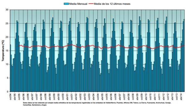
Historical evolution of the average monthly temperature in reservoirs
Source: Segura Basin Hydrological Plan 2015-2021
Average annual temperature in degrees centigrade
The absolute maximums, given the situation of the Segura river basin in the south-east of the peninsula, correspond to the appearance of winds from North Africa. Under these conditions, temperatures reach values close to 40ºC, reaching, in extreme situations, 45ºC.
Evapotranspiration
In the Segura river basin district, the average annual Real Evapotranspiration (ETR) is around 327.6 mm / year for the 1980-2005 series and 338.7 mm for the 1940-2005 series. The maximum ETR values are given in the Segura birth area, with values of up to 801.1 mm / year (1940-2005 series) and 793.3 (1980-2005 series). The minimum ETR values are 70.1 mm / year (1940-2005 series) and 27.2 mm / year (1980-2005 series). The coastal zone is the one with the lowest ETR.
The following map shows the distribution of this variable in the Segura river basin district.
Spatial distribution of real total annual evapotranspiration (mm / year) period 1980-2011
Source: Segura Basin Hydrological Plan 2015-2021
You can consult the Evaporation data at the stations of the Segura river basin district, at the following links:


